

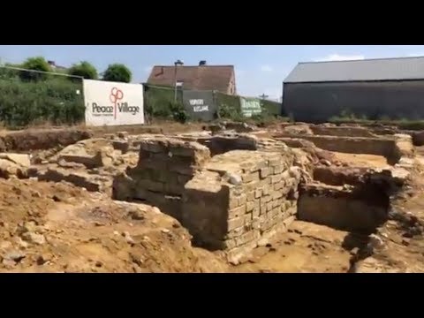
The rolling, green hills of West Flanders, Belgium, were once the bitter, brutal staging ground for some of the bloodiest fighting of World War I. An estimated 600,000 soldiers were killed, wounded, or went missing in that region between 1914 and 1918, often fighting along intricate but claustrophobically cramped trench lines that were perpetually bombarded by artillery fire and sinking into thick, waterlogged mud. However, a visitor walking across many of those old battlegrounds today might never know they were treading across a graveyard.
One of those sites (now called Dig Hill 80) was first uncovered in 2015, when archaeologists conducting routine tests stumbled onto what looked like a remarkably well-preserved German stronghold. But that same plot of land was also being scouted out by real estate developers. The find set off an emergency excavation that had to be completed on a tight deadline. Today, that site belongs to a row of unassuming single-family suburban homes. The physical space may have lost its battle with residential construction, but archivists are working to immortalize the site digitally. The Applied Research in Immersive Experiences and Simulations (ARIES) team at Virginia Tech has been working with valuable archival material from the excavation site, transforming thousands of photographs and other documentation into an accessible, virtual world.
Read Full Article: https://www.popsci.com/technology/wwi-trench-map-virtual-reality/
